No results found!
- Difficulty / Distance
- Easy
- 6.14km
- Altitudinal difference
- 234m
- 470m
- 236m
- Ascend/Descend
- 333m
- 52m
- 281m
- Duration
- 01:45
- 02:00
- Drinking water
- No
- Marking
- Red marks, round yellow signs
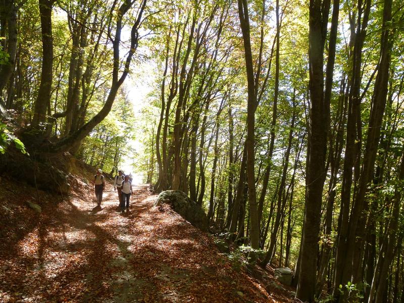
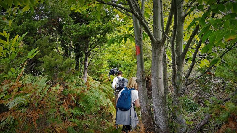
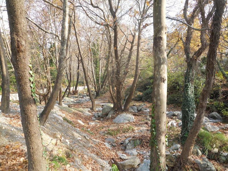
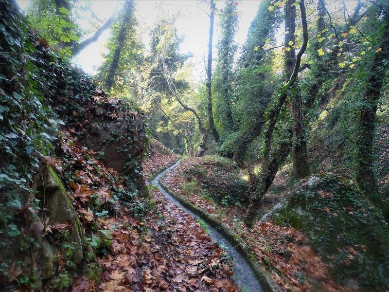
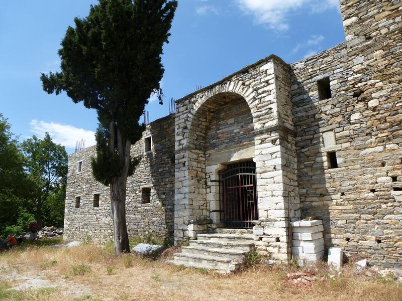
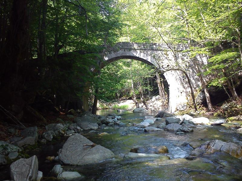
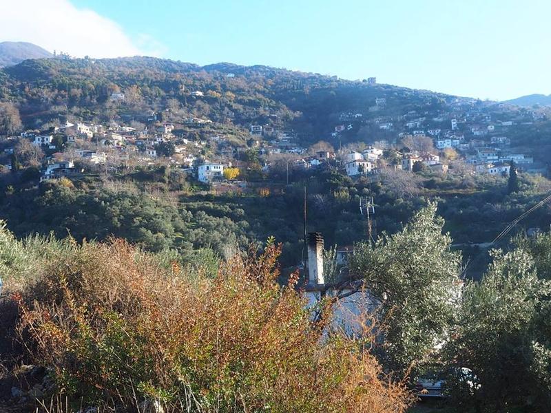
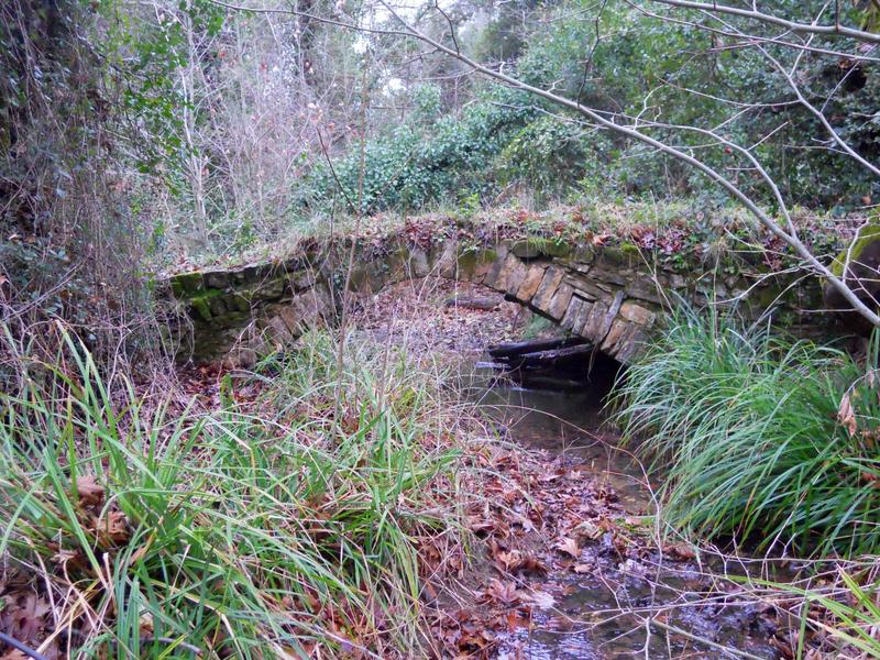
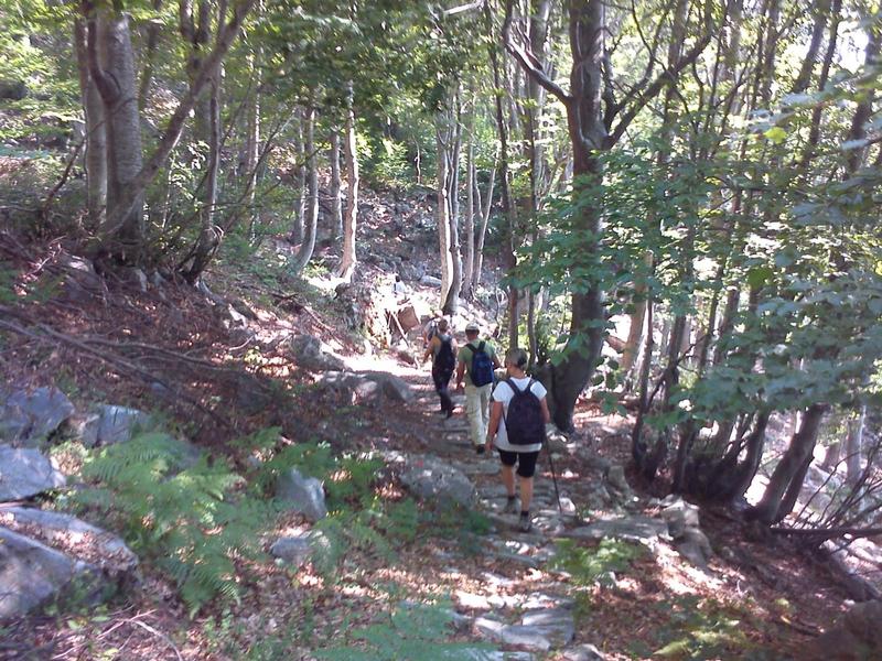
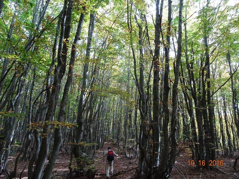
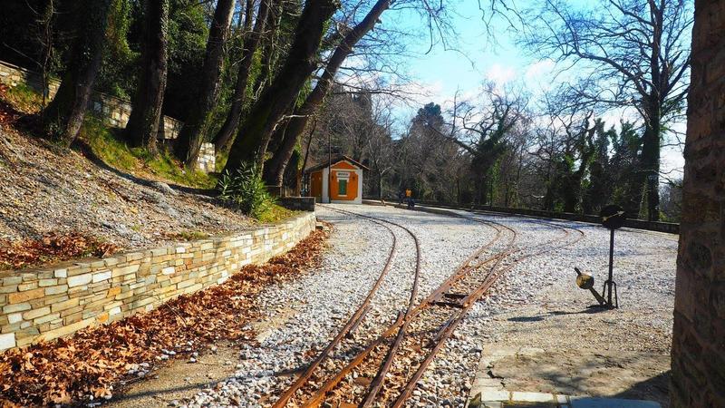
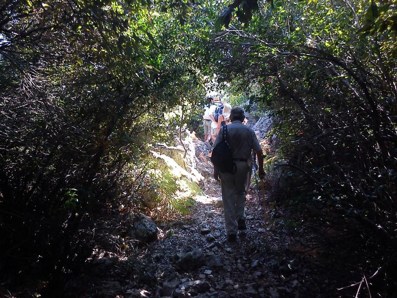
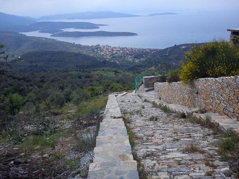
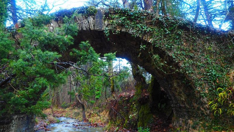
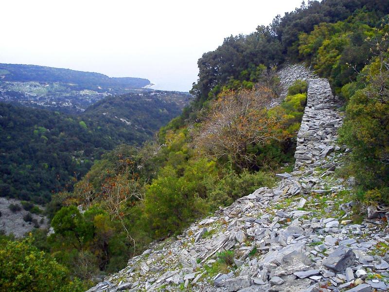
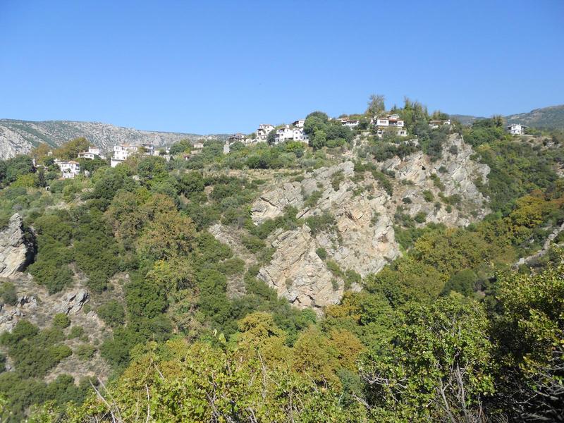
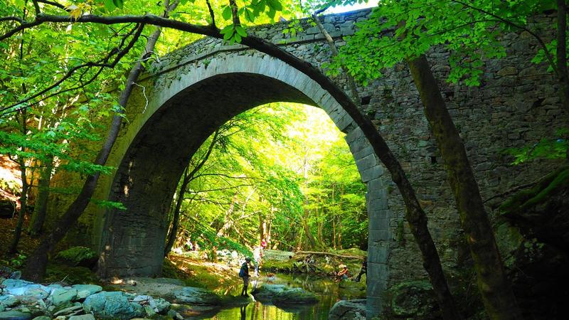
This is an easy walk mostly on recently cleared kalderimi. Its nicest spot is at the old stone bridge of Topalis near Neochori. We also enjoy nice views to the ...
Read more- Difficulty / Distance
- Moderate
- 5.12km
- Altitudinal difference
- 249m
- 252m
- 3m
- Ascend/Descend
- 516m
- 260m
- 256m
- Duration
- 02:12
- Drinking water
- Niaou square
- Marking
- Red marks, round yellow signs
We climb from Abovos beach of Afissos to the village of Niaou (Afetes) walking in the shadow of a cool dry riverbed (an exciting and fairly demanding walk, not ...
Read more- Difficulty / Distance
- Easy
- 1.94km
- Altitudinal difference
- 265m
- 285m
- 20m
- Ascend/Descend
- 261m
- 260m
- 1m
- Duration
- 0:51
- Drinking water
- Unknown
- Marking
- Unknown
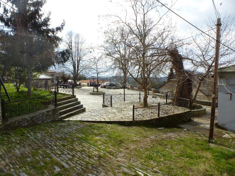
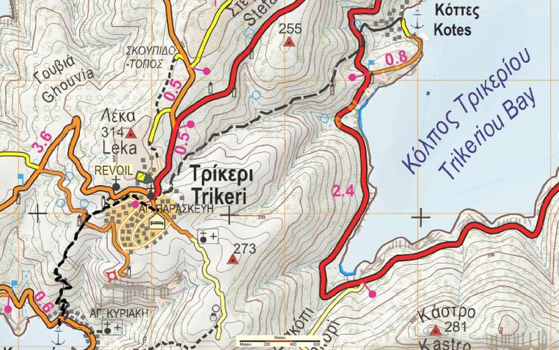
A 45-minute walk to climb the kalderimi from the seaside location of Agia Kyriaki to Trikeri village in South Pelion (οr vice versa...
Read more- Difficulty / Distance
- Easy
- 5.68km
- Altitudinal difference
- 595m
- 620m
- 25m
- Ascend/Descend
- 628m
- 29m
- 599m
- Duration
- 2:38
- Drinking water
- Ano Gatzea
- Marking
- Red marks, signs
One of Pelion mountain`s best routes, descending in 2 hours on kalderimi from Agios Georgios to the seaside village of Kato Gatzea. Start from the village ...
Read more- Difficulty / Distance
- Moderate
- 13.94km
- Altitudinal difference
- 767m
- 1295m
- 528m
- Ascend/Descend
- 1544m
- 739m
- 805m
- Duration
- 07:09
- Drinking water
- Petrostrougka springs, Mavromati
- Marking
- Red marks, signs
Starting from Agios Georgios village square, we climb initially on the route to Chania, passing from Mavromati spring, to reach the crossroads location of ...
Read more- Difficulty / Distance
- Moderate
- 15.02km
- Altitudinal difference
- 518m
- 1072m
- 554m
- Ascend/Descend
- 1230m
- 570m
- 660m
- Duration
- 06:12
- Drinking water
- Katsakari spring near Tsagarada
- Marking
- Red marks, metal signs
Τhis is the lower route from Agios Georgios to Tsagarada village, reaching 1070 m. altitude at Kourventeli location (the other route passing from Mega Isoma at ...
Read more- Difficulty / Distance
- Difficult
- 8.03km
- Altitudinal difference
- 338m
- 1100m
- 762m
- Ascend/Descend
- 2008m
- 1004m
- 1004m
- Duration
- 05:34
- Drinking water
- Unknown
- Marking
- Unknown
The route starts from the chapel of the Prophet Elias Agios Georgios Nilias, where there is a fountain. To go there we take the asphalt to the monastery of ...
Read more- Difficulty / Distance
- Moderate
- 13.5km
- Altitudinal difference
- 926m
- 1461m
- 535m
- Ascend/Descend
- 1716m
- 810m
- 906m
- Duration
- 06:30
- Drinking water
- East Refuge
- Marking
- Red marks, metal signs
This is one of the two walks from Agios Georgios to Tsagarada, reaching max altitude 1460 m. at Mega Isoma. Duration 6,5 hours. Most of it takes place in shady ...
Read more- Difficulty / Distance
- Easy
- 14.33km
- Altitudinal difference
- 683m
- 1314m
- 631m
- Ascend/Descend
- 1820m
- 910m
- 910m
- Duration
- 07:15
- Drinking water
- Petrostrougka-Mavromati-Kria Vrisi springs, Profitis Elias
- Marking
- Red marks, some metal signs
Start and finish at the square. Time 6,5-7 hours with stops, signing with red paint and some signs. Initially we climb towards Hania, passing from the drinking ...
Read more- Difficulty / Distance
- Moderate
- 13.89km
- Altitudinal difference
- 957m
- 1415m
- 458m
- Ascend/Descend
- 1785m
- 818m
- 967m
- Duration
- 05:34
- Drinking water
- Petrostrougka spring, East refuge
- Marking
- Red marks, metal signs
Climbing from Agios Georgios village square, we pass by Eastern Refuge to ultimately reach max altitude 1400 m, then descend in beech and chestnut forest to the...
Read more- Difficulty / Distance
- Easy
- 4.08km
- Altitudinal difference
- 101m
- 667m
- 566m
- Ascend/Descend
- 197m
- 86m
- 111m
- Duration
- 01:26
- Drinking water
- Alexeika (near Pinakates)
- Marking
- Red marks, round yellow signs
Τhis is a nice walk, on a path that was cleared and signed in 2018. Time 1,5 hours, signed with round yellow signs and red paint. Starting from Agios Georgios ...
Read more- Difficulty / Distance
- Easy
- 5.84km
- Altitudinal difference
- 234m
- 630m
- 396m
- Ascend/Descend
- 425m
- 251m
- 174m
- Duration
- 01:35
- 02:00
- Drinking water
- Ai Giannis chapel
- Marking
- Red marks, signs
An easy 2 hour walk (walking time 1.35'). Starting from Agios Lavrentios village square, we climb first to the homonymous monastery, then continue downhill to ...
Read more- Difficulty / Distance
- Moderate
- 14.42km
- Altitudinal difference
- 847m
- 1332m
- 485m
- Ascend/Descend
- 1743m
- 864m
- 879m
- Duration
- 04:55
- 06:30
- Drinking water
- Kria Vrisi
- Marking
- Red marks, signs
Walking time 4.55', total time 6,5 hours. Starting from Agios Lavrentios village square, pass from the old monastery and climb up to Monastiraki, then descend ...
Read more- Difficulty / Distance
- Moderate
- 9.91km
- Altitudinal difference
- 323m
- 637m
- 314m
- Ascend/Descend
- 870m
- 435m
- 435m
- Duration
- 03:00
- 04:00
- Drinking water
- Ai Giannis chapel
- Marking
- Red marks, signs
A circular walk, combining the two routes between Agios Vlasios and Agios Lavrentios (start and finish at the villages squares). The westerly route is passing ...
Read more- Difficulty / Distance
- Easy
- 14.15km
- Altitudinal difference
- 615m
- 627m
- 12m
- Ascend/Descend
- 1328m
- 689m
- 639m
- Duration
- 05:28
- Drinking water
- Unknown
- Marking
- Unknown
This walk starts at hotel Barbara opposite the EPSA (ΕΨΑ) beverage factory, at the traffic lights on the main road exiting Agria. We start walking on Apostolou ...
Read more- Difficulty / Distance
- Moderate
- 14.86km
- Altitudinal difference
- 1427m
- 1434m
- 7m
- Ascend/Descend
- 1709m
- 1529m
- 180m
- Duration
- 04:40
- 06:00
- Drinking water
- Agios Lavrentios, Kria Vriki
- Marking
- Red marks, signs
Αn ascent of 1430 m. on mt. Pelion, starting from hotel Barbara at Agria (at the traffic lights after hotel Valis) and finishing at the refuge at Hania ski ...
Read more- Difficulty / Distance
- Easy
- 4.06km
- Altitudinal difference
- 571m
- 631m
- 60m
- Ascend/Descend
- 550m
- 549m
- 1m
- Duration
- 01:41
- Drinking water
- Makrinitsa
- Marking
- Red marks, signs
Τhis is an easy climb from location Aidonofolies of Ano (Upper) Volos to the village of Makrinitsa. Walking time 1.25'. Starting from the asphalt road bridge at...
Read more- Difficulty / Distance
- Moderate
- 13.29km
- Altitudinal difference
- 789m
- 889m
- 100m
- Ascend/Descend
- 1914m
- 957m
- 957m
- Duration
- 06:11
- Drinking water
- Unknown
- Marking
- Red marks, signs, ribbons
Recording of the common Thessalian course (24/11/2019) organized by PAN Volos. Walking time 6 hours with stops. From the place Aidonofolies in Ano Volos (end of...
Read more- Difficulty / Distance
- Moderate
- 9.96km
- Altitudinal difference
- 613m
- 707m
- 94m
- Ascend/Descend
- 1252m
- 626m
- 626m
- Duration
- 05:12
- Drinking water
- Yes
- Marking
- Red marks, signs
This lovely circular walk through the stone paved paths of Pelion, starts at Aidonofolies at the outskirts of Volos. We can go there by city bus nr. 4 (end of ...
Read more- Difficulty / Distance
- Easy
- 1.95km
- Altitudinal difference
- 257m
- 398m
- 141m
- Ascend/Descend
- 249m
- 248m
- 1m
- Duration
- 00:52
- Drinking water
- Yes
- Marking
- Red marks
Α nice, 45-minute walk that climbs from Upper Volos (Ano Volos, location Aidonofolies) to the village of Stagiates. One can then continue walking to Portaria or...
Read more- Difficulty / Distance
- Easy
- 13.81km
- Altitudinal difference
- 377m
- 709m
- 332m
- Ascend/Descend
- 1332m
- 666m
- 666m
- Duration
- 08:00
- Drinking water
- No
- Marking
- Red marks
A fairly long circular route, with which we pass through two stone arched bridges in the ravine of Kaliakouda (Alevizou and Leschiani), from the monastery of ...
Read more- Difficulty / Distance
- Moderate
- 11.37km
- Altitudinal difference
- 984m
- 1199m
- 215m
- Ascend/Descend
- 1079m
- 1030m
- 49m
- Duration
- 04:31
- Drinking water
- Yes
- Marking
- Red marks, signs
Τhis walk climbs from Alli Meria village square (at the outskirts of Volos) to Katichori and finally to Hania, on the old route that connected Volos to ...
Read more- Difficulty / Distance
- Easy
- 3.94km
- Altitudinal difference
- 473m
- 639m
- 166m
- Ascend/Descend
- 473m
- 467m
- 6m
- Duration
- 01:36
- Drinking water
- Unknown
- Marking
- Unknown
A walk climbing from Anakasia in Upper Volos to the village of Portaria. There is access to start and finish by public transport (KTEL bus). Enjoy beautiful ...
Read more- Difficulty / Distance
- Moderate
- 17.95km
- Altitudinal difference
- 540m
- 965m
- 425m
- Ascend/Descend
- 1668m
- 834m
- 834m
- Duration
- 07:35
- Drinking water
- Flamouri monastery
- Marking
- Red marks
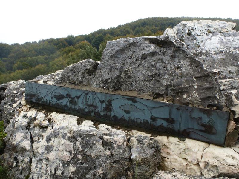
Τhis is a circular walk in North Pelion to visit Alfons` memorial at Kato Koromilia peak and the monastery of Flamouri. Walking time 5.40', with stops 7-7,5 h...
Read more- Difficulty / Distance
- Moderate
- 21.58km
- Altitudinal difference
- 588m
- 1038m
- 450m
- Ascend/Descend
- 1587m
- 693m
- 894m
- Duration
- 08:51
- Drinking water
- No
- Marking
- Red marks
Starting from the square of Ano Kerasia, walking mostly on path in beech forest and passing from the stone bridge of Poros, we reach the village of Pouri. Τhis ...
Read more- Difficulty / Distance
- Moderate
- 8.79km
- Altitudinal difference
- 464m
- 719m
- 255m
- Ascend/Descend
- 708m
- 148m
- 560m
- Duration
- 03:28
- Drinking water
- No
- Marking
- Red marks, signs
Αn excellent walk in North Pelion, mostly on kalderimi in oak forest. Start from the square of Ano Kerasia and follow the kalderimi on the left heading north. ...
Read more- Difficulty / Distance
- Easy
- 4.88km
- Altitudinal difference
- 558m
- 609m
- 51m
- Ascend/Descend
- 593m
- 17m
- 576m
- Duration
- 01:35
- 02:00
- Drinking water
- No
- Marking
- Red marks, signs
A nice walk, mostly on kalderimi. Starting from the main road junction at Ano Lechonia, initially we follow the asphalt to Agios Vlasios. After 100 m. at the V-...
Read more- Difficulty / Distance
- Easy
- 10.27km
- Altitudinal difference
- 609m
- 610m
- 1m
- Ascend/Descend
- 1215m
- 584m
- 631m
- Duration
- 04:49
- Drinking water
- Unknown
- Marking
- Unknown
A nice and easy walk, mostly on kalderimi. Time 4,5 hours, signed with signs and red marks. Starting from the main road junction at Ano Lechonia next to the ...
Read more- Difficulty / Distance
- Easy
- 6.45km
- Altitudinal difference
- 249m
- 311m
- 62m
- Ascend/Descend
- 604m
- 302m
- 302m
- Duration
- 03:04
- Drinking water
- Paliokastro, Agios Vlasios
- Marking
- Red marks, signs
Starting from the bus stop at the main road junction at Ano Lechonia, we get to Paliokastro following the old path (now mostly earth road) and continue on ...
Read more- Difficulty / Distance
- Easy
- 3.4km
- Altitudinal difference
- 222m
- 306m
- 84m
- Ascend/Descend
- 313m
- 283m
- 30m
- Duration
- 01:49
- Drinking water
- Paliokastro, Agios Vlasios
- Marking
- Red marks, signs
Starting from the bus stop at the main road junction at Ano Lechonia, we get to Paliokastro following the old path (now mostly earth road) and continue on ...
Read more- Difficulty / Distance
- Easy
- 4.39km
- Altitudinal difference
- 265m
- 279m
- 14m
- Ascend/Descend
- 290m
- 22m
- 268m
- Duration
- 01:30
- Drinking water
- Ai Giannis of Argalasti
- Marking
- Red marks, round signs

Αn easy, 1,5-hour walk to the seaside village of Horto on recently cleaned kalderimi-path. The first section from Argalasti square to Ai Giannis church is all ...
Read more- Difficulty / Distance
- Easy
- 4.29km
- Altitudinal difference
- 261m
- 261m
- 0m
- Ascend/Descend
- 328m
- 35m
- 293m
- Duration
- 01:36
- Drinking water
- Agia Triada church
- Marking
- Red marks, round yellow signs
An easy walk, mostly on cobbled stone path, from the village of Argalasti to the seaside location of Kalamos in South Pelion. Duration 1,15', signed with red ...
Read more- Difficulty / Distance
- Easy
- 7.02km
- Altitudinal difference
- 139m
- 320m
- 181m
- Ascend/Descend
- 451m
- 257m
- 194m
- Duration
- 02:15
- Drinking water
- Chatzovrisi Laukou
- Marking
- Red marks, signs
Another easy walk in South Pelion. Starting from Argalasti cemetery, the first half is on dirt road and the second half on path with bits of kalderimi (stone-...
Read more- Difficulty / Distance
- Easy
- 8.49km
- Altitudinal difference
- 254m
- 254m
- 0m
- Ascend/Descend
- 603m
- 185m
- 418m
- Duration
- 02:45
- Drinking water
- Lefokastro
- Marking
- Red marks, round signs
Another easy walk in South Pelion, on beautiful cobbled path from Argalasti down to the beaches of Lefokastro and Kalamos. Duration 2.45'. Using the path ...
Read more- Difficulty / Distance
- Moderate
- 14.93km
- Altitudinal difference
- 292m
- 292m
- 0m
- Ascend/Descend
- 946m
- 473m
- 473m
- Duration
- 05:10
- Drinking water
- Unknown
- Marking
- Red marks, round yellow signs
Τhis circular walk will take 5 hours (walking time 4.05'). Signed with red paint dots and round yellow signs. Starting from the square of Argalasti, we walk ...
Read more- Difficulty / Distance
- Easy
- 5.54km
- Altitudinal difference
- 130m
- 360m
- 230m
- Ascend/Descend
- 403m
- 188m
- 215m
- Duration
- 01:51
- Drinking water
- No
- Marking
- Red marks, round yellow signs
An easy and beautiful walk. Duration about 2 hours (walking time 1.40'). Starting from the road junction in Argalasti, we pass from fountain Kamara and the ...
Read more- Difficulty / Distance
- Easy
- 5.63km
- Altitudinal difference
- 365m
- 395m
- 30m
- Ascend/Descend
- 734m
- 367m
- 367m
- Duration
- 03:02
- Drinking water
- Damouchari, Mouresi square
- Marking
- Red marks, signs
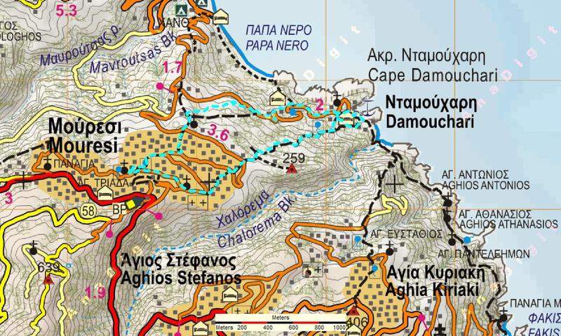
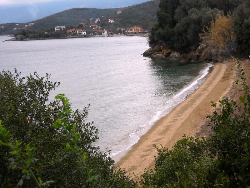
A circular walk to go from the beach of Damouchari to Mouresi village square and return. Duration 2,5 hours (walking time 1.50'). Another option is to go from ...
Read more- Difficulty / Distance
- Moderate
- 13.89km
- Altitudinal difference
- 494m
- 512m
- 18m
- Ascend/Descend
- 1612m
- 806m
- 806m
- Duration
- 06:35
- Drinking water
- Damouchari, Mouresi, Mavroutsa, Kissos
- Marking
- Red marks, metal signs
Circular walk lasting 6 hours including stops. Signed with red paint marks and metal signs. Start at the parking at Damouchari (or from Papa Nero beach at Agios...
Read more- Difficulty / Distance
- Easy
- 5.73km
- Altitudinal difference
- 335m
- 351m
- 16m
- Ascend/Descend
- 814m
- 407m
- 407m
- Duration
- 03:36
- Drinking water
- Vigla of Tsangarada, Damouchari
- Marking
- Red marks, some signs
This circular walk is best to start from Damouchari, where we can have a swim and lunch in the end. We climb up to Mouresi using the cobbled stone path (...
Read more- Difficulty / Distance
- Easy
- 3.52km
- Altitudinal difference
- 77m
- 560m
- 483m
- Ascend/Descend
- 182m
- 125m
- 57m
- Duration
- 01:10
- Drinking water
- No
- Marking
- Red marks, metal signs
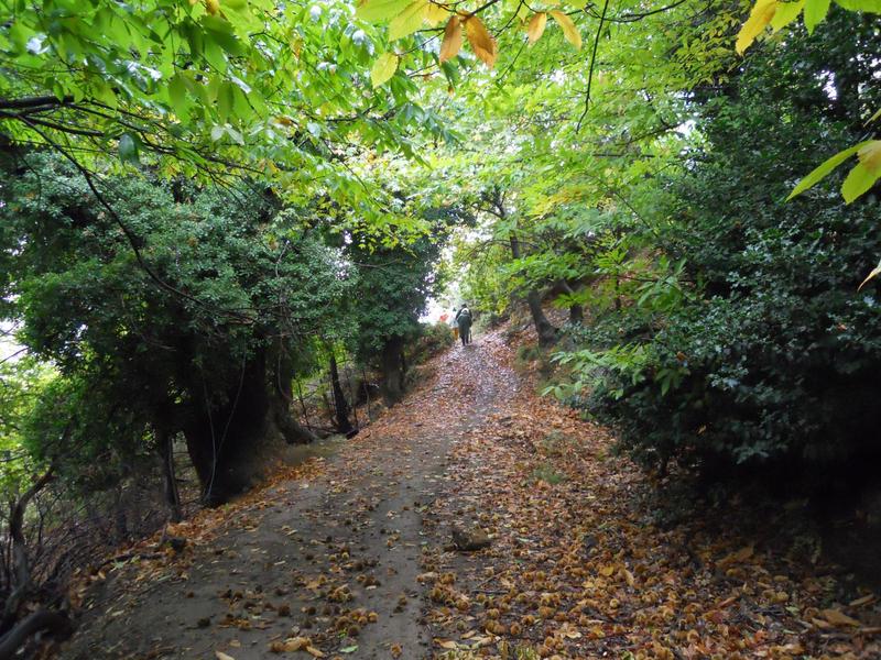
This is an easy and pleasant walk, mostly on earth road in chestnut forest. Duration 1 hour, signed with red paint dots. Start and finish at the villages` ...
Read more- Difficulty / Distance
- Moderate
- 16.6km
- Altitudinal difference
- 356m
- 685m
- 329m
- Ascend/Descend
- 922m
- 386m
- 536m
- Duration
- 05:10
- 06:00
- Drinking water
- No
- Marking
- Red marks, O2 signs
A part of O2 national trail, starting from the village of Εlafos, first section on path in oak forest, then on dirt road, final section on kalderimi. Walking ...
Read more- Difficulty / Distance
- Moderate
- 21.45km
- Altitudinal difference
- 815m
- 1288m
- 473m
- Ascend/Descend
- 2115m
- 1001m
- 1114m
- Duration
- 09:31
- Drinking water
- No
- Marking
- Red marks
One of the longest walks in Pelion, approx. 9 hours on an average pace. Start from Panagia Gorgoepikoos monastery at Fitoko close to Volos (go there by taxi or ...
Read more- Difficulty / Distance
- Moderate
- 7.1km
- Altitudinal difference
- 522m
- 700m
- 178m
- Ascend/Descend
- 809m
- 620m
- 189m
- Duration
- 03:00
- 03:30
- Drinking water
- No
- Marking
- Red marks, some signs
A nice walk, best suited to late autumn or early spring, amidst low vegetation that offers a spectacular view to Pagasitikos sea, the city of Volos and ...
Read more- Difficulty / Distance
- Moderate
- 11.33km
- Altitudinal difference
- 537m
- 965m
- 428m
- Ascend/Descend
- 1231m
- 587m
- 644m
- Duration
- 04:30
- Drinking water
- Flamouri monastery
- Marking
- Red marks, some signs
An excellent circular walk in North Pelion. From Ano Kerasia we follow the dirt road to Flamouri monastery. Our walk starts at the end of the road. In 25 min. ...
Read more- Difficulty / Distance
- Moderate
- 8.15km
- Altitudinal difference
- 325m
- 1525m
- 1200m
- Ascend/Descend
- 744m
- 372m
- 372m
- Duration
- 03:43
- Drinking water
- No
- Marking
- Red marks
This circular walk in beech forest uses forest roads and sections of paths created for UTP, a mountain running race held in Pelion. A small part of it is ...
Read more- Difficulty / Distance
- Moderate
- 12.02km
- Altitudinal difference
- 1177m
- 1177m
- 0m
- Ascend/Descend
- 1203m
- 31m
- 1172m
- Duration
- 04:38
- Drinking water
- Anilio
- Marking
- Red marks, some signs
Ιn this walk we start from the Hania ski center through dense beech and chestnut forest, heading down to the village of Anilio and finally to the excellent ...
Read more- Difficulty / Distance
- Moderate
- 14.95km
- Altitudinal difference
- 315m
- 1478m
- 1163m
- Ascend/Descend
- 1656m
- 828m
- 828m
- Duration
- 07:37
- Drinking water
- Unknown
- Marking
- Red marks, metal signs
This is a 7-hour cirular walk with start and finish at Hania ski center. Walking in beech forest, we head east passing successively from four peaks of Central ...
Read more- Difficulty / Distance
- Moderate
- 19.69km
- Altitudinal difference
- 1416m
- 1427m
- 11m
- Ascend/Descend
- 1967m
- 342m
- 1625m
- Duration
- 07:33
- Drinking water
- Eastern refuge, Xourichti
- Marking
- Red marks, metal signs
Starting from the refuge at Hania ski center, we reach the Eastern Refuge in 2.05' and continue in beech forest to the village of Xourichti and finally to the ...
Read more- Difficulty / Distance
- Moderate
- 16.86km
- Altitudinal difference
- 1419m
- 1419m
- 0m
- Ascend/Descend
- 1788m
- 254m
- 1534m
- Duration
- 07:07
- Drinking water
- Mouresi square
- Marking
- Red marks, signs
From the refuge of the ski center at Chania to the Aegean sea. Duration 7 h, walking time 6 h. The route is signed with red paint marks, except the section ...
Read more- Difficulty / Distance
- Moderate
- 10.67km
- Altitudinal difference
- 1166m
- 1190m
- 24m
- Ascend/Descend
- 1230m
- 44m
- 1186m
- Duration
- 04:15
- Drinking water
- Kissos, Ag. Dimitrios
- Marking
- Red marks, signs
Α 3,5 hour and 1200 m. altitude descent from Hania ski center to Kissos village and finally to the beach of Ai Giannis at the Aegean sea. Alternate sections of ...
Read more- Difficulty / Distance
- Moderate
- 9.2km
- Altitudinal difference
- 884m
- 1189m
- 305m
- Ascend/Descend
- 1335m
- 218m
- 1117m
- Duration
- 05:40
- Drinking water
- Panagitsa
- Marking
- Red marks, round signs
Τhis is the newest version of the excellent Path of the Waterfalls Hania-Makrirachi. The final section of the walk, after the last waterfall at Kavouria, ...
Read more- Difficulty / Distance
- Moderate
- 8.45km
- Altitudinal difference
- 889m
- 1214m
- 325m
- Ascend/Descend
- 935m
- 40m
- 895m
- Duration
- 04:07
- Drinking water
- No
- Marking
- Red marks, metal signs
This is the old path connecting the village of Makrirachi to Chania and Volos. It was reopened and signed in 2015. Walking time 3,5 h, total time 4 h. Starting ...
Read more- Difficulty / Distance
- Moderate
- 14.46km
- Altitudinal difference
- 951m
- 1477m
- 526m
- Ascend/Descend
- 1893m
- 556m
- 1337m
- Duration
- 07:10
- Drinking water
- No
- Marking
- Red marks, metal signs
Α classic trek in Pelion mountain, passing from peaks Agriolefkes, Golgothas, Schitzouravli, Dramala, Mega Isoma. Start from the refuge at Hania ski center and ...
Read more- Difficulty / Distance
- Moderate
- 12.95km
- Altitudinal difference
- 933m
- 1439m
- 506m
- Ascend/Descend
- 2993m
- 1179m
- 1814m
- Duration
- 05:30
- Drinking water
- No
- Marking
- Red marks, signs
Setting off from the refuge at hania ski center, we walk on the path to Golgothas and reaching the earth road at location Monastiraki we turn left, walk on the ...
Read more- Difficulty / Distance
- Moderate
- 9.5km
- Altitudinal difference
- 741m
- 1218m
- 477m
- Ascend/Descend
- 1528m
- 765m
- 763m
- Duration
- 04:20
- Drinking water
- asphalt road near Zagora
- Marking
- Red marks, yellow metal signs
This walk has three sections: first, on cobblestone (kalderimi) in beech forest from Pileas hotel at Hania to Profitis Elias chapel (1,5 h.). Second, ...
Read more- Difficulty / Distance
- Moderate
- 9.06km
- Altitudinal difference
- 918m
- 1204m
- 286m
- Ascend/Descend
- 1135m
- 120m
- 1015m
- Duration
- 05:08
- Drinking water
- Panagitsa
- Marking
- Red marks, round signs
Αn excellent path in beech and chestnut forest, unknown until recently (first time walked 29 May 2016), crossing three times the Megalo rema stream amid ...
Read more- Difficulty / Distance
- Moderate
- 7.61km
- Altitudinal difference
- 180m
- 193m
- 13m
- Ascend/Descend
- 834m
- 414m
- 420m
- Duration
- 04:19
- Drinking water
- Panagia Faneromeni chapel
- Marking
- Red marks, round signs
Τhis route from Horefto to Ai Giannis is beautiful but a little demanding, as it uses an overgrown and steep path from Banikas beach towards Panagia Faneromeni ...
Read more- Difficulty / Distance
- Moderate
- 16.78km
- Altitudinal difference
- 733m
- 764m
- 31m
- Ascend/Descend
- 1836m
- 918m
- 918m
- Duration
- 07:30
- Drinking water
- Unknown
- Marking
- Unknown
Starting from Horefto, we go up to the church Metamorfosi (Sotira) of Zagora. Then we go up a little further, we cross the stream of Kalokairinou having seen ...
Read more- Difficulty / Distance
- Moderate
- 10.04km
- Altitudinal difference
- 57m
- 64m
- 7m
- Ascend/Descend
- 525m
- 261m
- 264m
- Duration
- 03:44
- Drinking water
- No
- Marking
- Red marks, round signs
Α nice walk along the coast from Horto to Lefokastro, marked with round signs and red marks by the Friends of Kalderimi Assosiation of South Pelion...
Read more- Difficulty / Distance
- Easy
- 6.34km
- Altitudinal difference
- 279m
- 279m
- 0m
- Ascend/Descend
- 558m
- 279m
- 279m
- Duration
- 02:45
- Drinking water
- Metochi fountain
- Marking
- Round yellow signs
A 2-hour circular walk from the seaside location of Chorto to Metochi and back. The first part is mostly earth road and the second part kalderimi or path. Start...
Read more- Difficulty / Distance
- Moderate
- 11.78km
- Altitudinal difference
- 382m
- 386m
- 4m
- Ascend/Descend
- 810m
- 405m
- 405m
- Duration
- 05:27
- Drinking water
- Milies
- Marking
- Red marks, signs
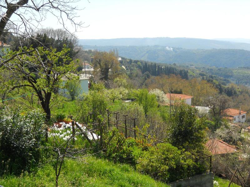
Starting off from the seaside of Kala Nera, we climb up to the square of Milies on the main kalderimi and return back by a different easterly route that follows...
Read more- Difficulty / Distance
- Easy
- 4.86km
- Altitudinal difference
- 368m
- 386m
- 18m
- Ascend/Descend
- 406m
- 387m
- 19m
- Duration
- 02:48
- Drinking water
- No
- Marking
- Red marks
An easy, classic walk on mt.Pelion connecting the seaside resort of Kala Nera to the picturesque village of Milies. Duration 1,5 hours, mostly on cobblestone ...
Read more- Difficulty / Distance
- Moderate
- 13.73km
- Altitudinal difference
- 387m
- 400m
- 13m
- Ascend/Descend
- 1174m
- 588m
- 586m
- Duration
- 04:30
- 06:37
- Drinking water
- Unknown
- Marking
- Unknown
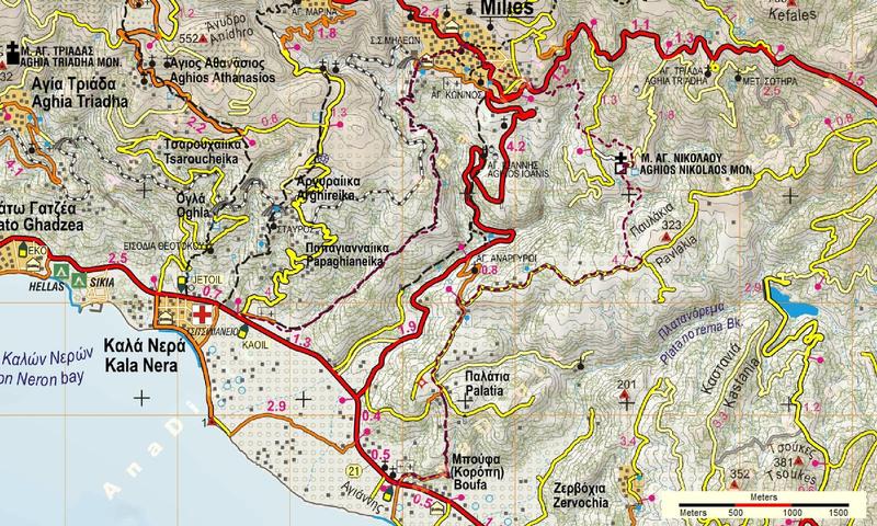
Τhis is a nice and almost circular walk. Start from the asphalt at Kala Nera (at the sign to Argyreika), climb the kalderimi to Milies, then continue on ...
Read more- Difficulty / Distance
- Easy
- 5.24km
- Altitudinal difference
- 599m
- 599m
- 0m
- Ascend/Descend
- 657m
- 629m
- 28m
- Duration
- 02:18
- Drinking water
- Agia Kiriaki (near Pinakates)
- Marking
- Red marks, signs
Α classic walk in Pelion, mostly on kalderimi. Total time 2.10', walking time 1.50'. Signed with red paint marks and yellow metal signs. Start from the seaside ...
Read more- Difficulty / Distance
- Moderate
- 13.96km
- Altitudinal difference
- 586m
- 586m
- 0m
- Ascend/Descend
- 1416m
- 708m
- 708m
- Duration
- 06:21
- Drinking water
- Yes
- Marking
- Red marks, signs
A circular walk, from the beach of Kala Nera, that joins three picturesque Pelion villages (Pinakates, Vizitsa, Milies) to the sea. Total time with stops 5,5 ...
Read more- Difficulty / Distance
- Moderate
- 13.3km
- Altitudinal difference
- 518m
- 522m
- 4m
- Ascend/Descend
- 1388m
- 694m
- 694m
- Duration
- 04:45
- 06:00
- Drinking water
- Yes
- Marking
- Red marks, yellow metal signs
Starting from the beach of Kala Nera, with this circular walk (mostly on kalderimi) we can visit Vizitsa village, the train station of Milies and several ...
Read more- Difficulty / Distance
- Easy
- 6.65km
- Altitudinal difference
- 276m
- 288m
- 12m
- Ascend/Descend
- 612m
- 301m
- 311m
- Duration
- 02:35
- Drinking water
- Paou mon.
- Marking
- Red marks, round yellow signs
From the seaside settlement of Kalamos, we walk south to the beaches of Belian and Paou, then to the monastery of Paou and finally to the village of Argalasti. ...
Read more- Difficulty / Distance
- Easy
- 2.98km
- Altitudinal difference
- 332m
- 333m
- 1m
- Ascend/Descend
- 336m
- 330m
- 6m
- Duration
- 01:05
- Drinking water
- No
- Marking
- Red marks
A 1-hour walk from Kamari beach to the village of Keramidi, following the route of the old kalderimi. Mostly earth road with some stretches of kalderimi. This ...
Read more- Difficulty / Distance
- Moderate
- 15.07km
- Altitudinal difference
- 612m
- 704m
- 92m
- Ascend/Descend
- 1476m
- 722m
- 754m
- Duration
- 05:30
- 07:42
- Drinking water
- No
- Marking
- Red marks, some signs
In this circular route, starting from Kanalia village square, we have the opportunity to visit the site of "Drakopigado", a large vertical cave with stalactites...
Read more- Difficulty / Distance
- Moderate
- 8.65km
- Altitudinal difference
- 427m
- 523m
- 96m
- Ascend/Descend
- 916m
- 458m
- 458m
- Duration
- 03:30
- Drinking water
- Unknown
- Marking
- Unknown
This is a circular route to visit the cave "Drakopigado" similar to Kanalia - Drakopigado - souvala Manoli but shorter (almost half the length), so easier (...
Read more- Difficulty / Distance
- Easy
- 9.18km
- Altitudinal difference
- 370m
- 435m
- 65m
- Ascend/Descend
- 733m
- 398m
- 335m
- Duration
- 03:50
- Drinking water
- No
- Marking
- Red marks, signs
This is a fairly easy walk, starting from the old byzantine church of Agios Nikolaos near Kanalia. Initially follow the ancient path that connected lake Karla ...
Read more- Difficulty / Distance
- Moderate
- 12.44km
- Altitudinal difference
- 606m
- 706m
- 100m
- Ascend/Descend
- 1136m
- 680m
- 456m
- Duration
- 03:50
- 05:12
- Drinking water
- Ano Kanalia
- Marking
- Red marks, some signs
A 5-hour walk (moving time 3.50') in North Pelion, mostly on kalderimi. This is the historical route connecting Keramidi to Kanalia and Volos until the early 60...
Read more- Difficulty / Distance
- Moderate
- 13.19km
- Altitudinal difference
- 613m
- 673m
- 60m
- Ascend/Descend
- 1128m
- 658m
- 470m
- Duration
- 04:50
- Drinking water
- Unknown
- Marking
- Unknown
One of the best walks in Pelion, linking lake Karla to the northeastern coast. Half of it is on cobbled path (kalderimi) into oak forest. Duration 5 hours, max ...
Read more- Difficulty / Distance
- Moderate
- 10.65km
- Altitudinal difference
- 363m
- 369m
- 6m
- Ascend/Descend
- 715m
- 456m
- 259m
- Duration
- 02:45
- 03:30
- Drinking water
- No
- Marking
- Red marks
A 3,5 hour walk (normal pace including stops) from the seaside location of Kantiragas (Chrysi Akti Panagias) close to the city of Volos, to the village of ...
Read more- Difficulty / Distance
- Easy
- 5.24km
- Altitudinal difference
- 327m
- 434m
- 107m
- Ascend/Descend
- 418m
- 76m
- 342m
- Duration
- 01:30
- 02:50
- Drinking water
- No
- Marking
- Red marks, yellow signs
An easy walk on the path between the villages of Kapourna (or Glafira) and Kato Kerasia. Walking time 1.30', signed with red marks (attention). We enjoy nice ...
Read more- Difficulty / Distance
- Easy
- 1.46km
- Altitudinal difference
- 51m
- 53m
- 2m
- Ascend/Descend
- 143m
- 70m
- 73m
- Duration
- 00:28
- Drinking water
- No
- Marking
- Round yellow signs
This is a pleasant half-an-hour walk on path in pine forest between the two beaches on South Pelion`s east coast. Signed with round yellow signs...
Read more- Difficulty / Distance
- Easy
- 4.95km
- Altitudinal difference
- 561m
- 672m
- 111m
- Ascend/Descend
- 592m
- 571m
- 21m
- Duration
- 01:30
- Drinking water
- No
- Marking
- Red marks, signs
This walk takes us in 1,5 hour to the deserted village of Ano Kerasia, following the route of its former inhabitants as they migrated from the upper to the ...
Read more- Difficulty / Distance
- Moderate
- 17.74km
- Altitudinal difference
- 316m
- 425m
- 109m
- Ascend/Descend
- 1248m
- 624m
- 624m
- Duration
- 05:45
- 07:16
- Drinking water
- Unknown
- Marking
- Red marks, some signs
A circular route starting from and returning to Kato Kerasia, most of it on a path in a forest of oaks. Suitable mainly for winter, from October to March-April...
Read more- Difficulty / Distance
- Easy
- 7.67km
- Altitudinal difference
- 488m
- 516m
- 28m
- Ascend/Descend
- 911m
- 213m
- 698m
- Duration
- 02:20
- 03:00
- Drinking water
- Mavroutsa, Mouresi
- Marking
- Red marks, signs
An excellent walk, mostly on kalderimi (cobbled stone path). From Kissos village square walk downhill to pass the Kissotiko stream and reach Mouresi. Then ...
Read more- Difficulty / Distance
- Moderate
- 2.87km
- Altitudinal difference
- 78m
- 535m
- 457m
- Ascend/Descend
- 275m
- 167m
- 108m
- Duration
- 00:45
- Drinking water
- Unknown
- Marking
- Red marks
Α visit to the springs of Timpanos near Kissos is an absolute must. Double waterfalls, water pond for an icy swim, huge rocks, water coming from everywhere. ...
Read more- Difficulty / Distance
- Difficult
- 6.26km
- Altitudinal difference
- 441m
- 934m
- 493m
- Ascend/Descend
- 656m
- 328m
- 328m
- Duration
- 01:56
- 02:58
- Drinking water
- Unknown
- Marking
- Unknown
Starting point from the village square and the cement road to the source of daimaki .. continuing on the dirt road and descending we find the stream with ...
Read more- Difficulty / Distance
- Easy
- 13.54km
- Altitudinal difference
- 310m
- 311m
- 1m
- Ascend/Descend
- 1250m
- 625m
- 625m
- Duration
- 05:30
- Drinking water
- No
- Marking
- Round yellow signs
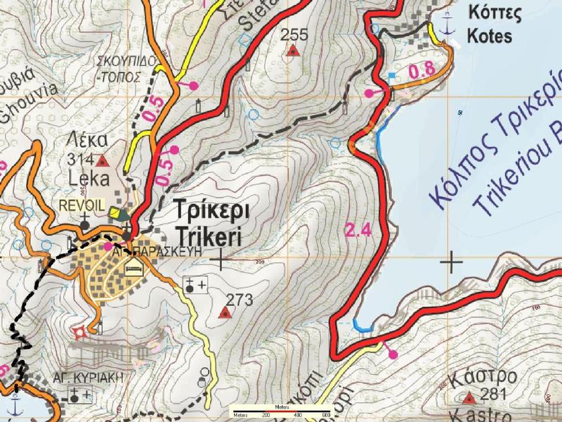
In this circular walk, starting from the seaside at Kottes, we climb for one hour up to Trikeri square, where we can have a stop for refreshments. Walking ...
Read more- Difficulty / Distance
- Easy
- 0.87km
- Altitudinal difference
- 67m
- 461m
- 394m
- Ascend/Descend
- 41m
- 7m
- 34m
- Duration
- 0:17
- 0:21
- Drinking water
- Unknown
- Marking
- Unknown
- Difficulty / Distance
- Easy
- 7.8km
- Altitudinal difference
- 195m
- 376m
- 181m
- Ascend/Descend
- 436m
- 176m
- 260m
- Duration
- 02:15
- 03:09
- Drinking water
- at the monastery (if open)
- Marking
- Red marks, round yellow signs
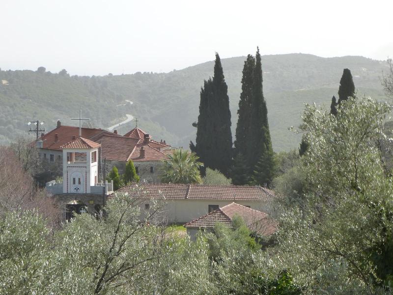
Although this may not be the shortest route Lafkos to Promiri, it certainly is the nicest. Starting from Lafkos on the way towards Platania, when we meet the ...
Read more- Difficulty / Distance
- Moderate
- 14.63km
- Altitudinal difference
- 374m
- 382m
- 8m
- Ascend/Descend
- 880m
- 291m
- 589m
- Duration
- 03:38
- 04:20
- Drinking water
- Unknown
- Marking
- Unknown
This walk takes us on earth roads and footpaths on a beautiful route through forest and olive groves. Much of it is shady in summer. It passes the monastery of ...
Read more- Difficulty / Distance
- Easy
- 6.19km
- Altitudinal difference
- 367m
- 367m
- 0m
- Ascend/Descend
- 555m
- 119m
- 436m
- Duration
- 02:15
- Drinking water
- Agios Nikolaos
- Marking
- Red marks
An easy walk from the village of Lafkos in South Pelion to the Aegean sea location of Platanias. Duration 2.15'. This is the main (eastern) path via Agios ...
Read more- Difficulty / Distance
- Moderate
- 7.08km
- Altitudinal difference
- 303m
- 329m
- 26m
- Ascend/Descend
- 685m
- 197m
- 488m
- Duration
- 02:10
- 02:47
- Drinking water
- No
- Marking
- Red marks, signs

This is the alternative (western) route from Lafkos to Platanias that passes by Ai Giannis chapel, in addition to the main (eastern) route via Agios Nikolaos ...
Read more- Difficulty / Distance
- Easy
- 12.39km
- Altitudinal difference
- 259m
- 259m
- 0m
- Ascend/Descend
- 942m
- 471m
- 471m
- Duration
- 03:40
- 04:38
- Drinking water
- Unknown
- Marking
- Unknown
This is a lovely circular walk in South Pelion. It took us 4 hours (walking time 3.40'). Most of the walk is on cobbled stone path and we pass over the stone ...
Read more- Difficulty / Distance
- Easy
- 12.56km
- Altitudinal difference
- 268m
- 268m
- 0m
- Ascend/Descend
- 842m
- 421m
- 421m
- Duration
- 05:31
- Drinking water
- Unknown
- Marking
- Red marks, round yellow signs
This circular walk will take about 5 hours including stops. Start either from Lefokastro or Argalasti or even Kalamos. Signed with red paint and round yellow ...
Read more- Difficulty / Distance
- Easy
- 4.76km
- Altitudinal difference
- 275m
- 370m
- 95m
- Ascend/Descend
- 363m
- 314m
- 49m
- Duration
- 01:30
- 01:45
- Drinking water
- No
- Marking
- Red marks, some signs
Αn easy walk on the ancient trail that connected the village of Kapourna (ancient Glafyrai) and lake Karla to the sea. Start from the stone bridge at Louziniko...
Read more- Difficulty / Distance
- Easy
- 7.74km
- Altitudinal difference
- 205m
- 321m
- 116m
- Ascend/Descend
- 520m
- 267m
- 253m
- Duration
- 02:20
- 03:00
- Drinking water
- No
- Marking
- Red marks
Starting from the stone bridge of Louziniko, close to the city of Volos, we get to the village of Kerasia walking on the old path that was in use until early ...
Read more- Difficulty / Distance
- Moderate
- 19.22km
- Altitudinal difference
- 805m
- 1434m
- 629m
- Ascend/Descend
- 2037m
- 907m
- 1130m
- Duration
- 09:00
- Drinking water
- Agia Paraskevi, Elatorema, Krio Nero
- Marking
- Red marks, metal signs
This is a 9-hour circular walk from Makrinitsa, which combines two of the four available path routes to the mountaintop towards Pouri. Distance 20,3 km, signed ...
Read more- Difficulty / Distance
- Moderate
- 14.37km
- Altitudinal difference
- 837m
- 965m
- 128m
- Ascend/Descend
- 1442m
- 479m
- 963m
- Duration
- 05:43
- Drinking water
- Leschiani
- Marking
- Red marks
Α 5,5-hour walk from Makrinitsa to Kato Kerasia, passing from the old stone bridge of Leschiani. Mostly bushy vegetation, best suited to spring or late autumn. ...
Read more- Difficulty / Distance
- Moderate
- 19.03km
- Altitudinal difference
- 835m
- 1308m
- 473m
- Ascend/Descend
- 2027m
- 951m
- 1076m
- Duration
- 06:25
- 08:48
- Drinking water
- Agia Paraskevi (and Profitis Ilias), Krio Nero, hunders hut
- Marking
- Red marks, some metal signs
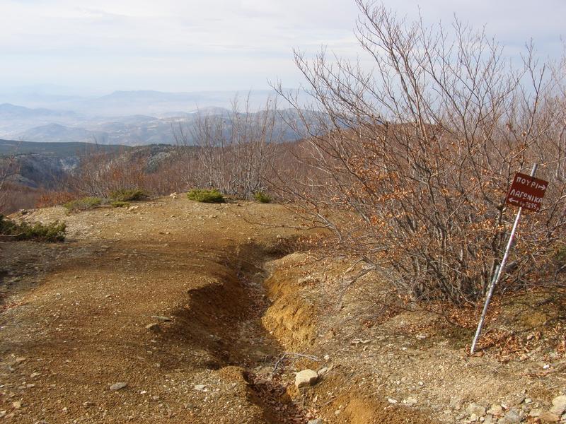
This is the westerly route from Makrinitsa to Pouri, passing from Lagonika peak at 1300 m. (the other two routes are Makrinitsa-Western Refuge-Pouri and ...
Read more- Difficulty / Distance
- Moderate
- 17.23km
- Altitudinal difference
- 1099m
- 1590m
- 491m
- Ascend/Descend
- 2042m
- 920m
- 1122m
- Duration
- 05:50
- 07:52
- Drinking water
- Agia Paraskevi church near Makrinitsa
- Marking
- Red marks, some metal signs
WARNING: Do not attempt to walk on this route without prior permission from the Air Force authorities (tel. +302421076180), otherwise you risk being arrested ...
Read more- Difficulty / Distance
- Moderate
- 21.13km
- Altitudinal difference
- 951m
- 1560m
- 609m
- Ascend/Descend
- 2141m
- 1066m
- 1075m
- Duration
- 09:00
- Drinking water
- Agia Paraskevi, Krio Nero
- Marking
- Red marks, some signs
Starting from the parking at the end of the asphalt in Makrinitsa, we climb in a northeast direction passing from the old monastery of Agia Paraskevi and ...
Read more- Difficulty / Distance
- Moderate
- 22.89km
- Altitudinal difference
- 1053m
- 1186m
- 133m
- Ascend/Descend
- 2145m
- 841m
- 1304m
- Duration
- 07:00
- 09:47
- Drinking water
- Unknown
- Marking
- Unknown
A long trek (walking time 7 hours, total time 8,5-9 h.) into the beech and oak forests of NW Pelion. Starting from Makrinitsa village square, we pass from ...
Read more- Difficulty / Distance
- Easy
- 5.76km
- Altitudinal difference
- 345m
- 629m
- 284m
- Ascend/Descend
- 702m
- 367m
- 335m
- Duration
- 02:25
- Drinking water
- Yes
- Marking
- Red marks, signs

Α superb 2-hour round walk from Makrinitsa to Stagiates and back, mostly on kalderimi and path, offering breathtaking views over Volos and Pagasitikos gulf...
Read more- Difficulty / Distance
- Moderate
- 8.86km
- Altitudinal difference
- 494m
- 888m
- 394m
- Ascend/Descend
- 1270m
- 635m
- 635m
- Duration
- 03:20
- 04:51
- Drinking water
- Makrinitsa, Stagiates, Mana spring
- Marking
- Red marks, signs
After a new path was opened in 2018 connecting the spring Mana at Portaria to Makrinitsa, crossing the Mega Rema stream at a level higher than the asphalt road...
Read more- Difficulty / Distance
- Moderate
- 13.18km
- Altitudinal difference
- 681m
- 1291m
- 610m
- Ascend/Descend
- 1331m
- 670m
- 661m
- Duration
- 06:40
- Drinking water
- Agia Paraskevi, Profitis Ilias
- Marking
- Red marks
A circular walk ascending from Makrinitsa village to the area of Trano Isoma via Agia Paraskevi church and descending back via Profitis Ilias church. Enjoy ...
Read more- Difficulty / Distance
- Moderate
- 26km
- Altitudinal difference
- 801m
- 971m
- 170m
- Ascend/Descend
- 3054m
- 1334m
- 1720m
- Duration
- 09:00
- 11:00
- Drinking water
- Flamouri monastery
- Marking
- Red marks, some signs
This is a long trek in North Pelion (walking time 9 hours, total 10,5-11 h). Recommended May to September, starting early in the morning because of the long ...
Read more- Difficulty / Distance
- Moderate
- 21.42km
- Altitudinal difference
- 960m
- 1434m
- 474m
- Ascend/Descend
- 2062m
- 974m
- 1088m
- Duration
- 07:00
- 09:18
- Drinking water
- Agia Paraskevi, Krio Nero
- Marking
- Red marks, some metal signs
A classic hiking route, one of the longest in Pelion. Starting from the end of the asphalt at Makrinitsa, we reach max altitude 1434 m in beech forest and ...
Read more- Difficulty / Distance
- Easy
- 2.47km
- Altitudinal difference
- 207m
- 369m
- 162m
- Ascend/Descend
- 331m
- 201m
- 130m
- Duration
- 01:00
- Drinking water
- No
- Marking
- Red marks, round yellow signs
Walking time 1 hour, signed with red paint dots and some yellow round signs. Starting from the square of Makrirachi, we take the kalderimi just next to the ...
Read more- Difficulty / Distance
- Easy
- 4.23km
- Altitudinal difference
- 181m
- 947m
- 766m
- Ascend/Descend
- 316m
- 128m
- 188m
- Duration
- 01:39
- Drinking water
- Unknown
- Marking
- Unknown
This walk starts from the bend of the main asphalt road to Hania, near a drinking water fountain. Walking on earth road, we get to the hunters' refuge at ...
Read more- Difficulty / Distance
- Moderate
- 12.55km
- Altitudinal difference
- 385m
- 385m
- 0m
- Ascend/Descend
- 1011m
- 314m
- 697m
- Duration
- 05:39
- Drinking water
- at Pavlakia, Zervochia
- Marking
- Red marks, round yellow signs
This is a fullfilling and varied walk, lasting about 5 hours, that leads from the village of Milies to Abovos beach at Afissos, through the ravine of Chalorema...
Read more- Difficulty / Distance
- Moderate
- 8.46km
- Altitudinal difference
- 348m
- 378m
- 30m
- Ascend/Descend
- 755m
- 381m
- 374m
- Duration
- 03:00
- Drinking water
- No
- Marking
- Red marks
A round trip from Milies square to the location of Belegrinos close to the seaside resort of Kala Nera. Taking the kalderimi towards Boufa at first, we cross ...
Read more- Difficulty / Distance
- Easy
- 5.61km
- Altitudinal difference
- 360m
- 377m
- 17m
- Ascend/Descend
- 541m
- 93m
- 448m
- Duration
- 02:14
- Drinking water
- Agii Anargiri chapel
- Marking
- Red marks, metal signs
A nice 2-hour walk, mostly on downhill kalderimi, to the beach of Boufa (officially Koropi). It passes from a stone bridge and the churches of Agios ...
Read more- Difficulty / Distance
- Moderate
- 9.37km
- Altitudinal difference
- 662m
- 674m
- 12m
- Ascend/Descend
- 975m
- 302m
- 673m
- Duration
- 04:02
- Drinking water
- Lambinou village
- Marking
- Red marks, signs
An excellent walk. Starting from Milies square, we walk initially on the kalderimi to Tsagarada. Reaching the kiosk, turn right and follow a narrow path ...
Read more- Difficulty / Distance
- Moderate
- 12.21km
- Altitudinal difference
- 651m
- 662m
- 11m
- Ascend/Descend
- 1530m
- 815m
- 715m
- Duration
- Drinking water
- Unknown
- Marking
- Unknown
Starting point is the village of Milies. We follow the path that starts above the church of the square to Tsagarada. Somewhere in the middle of the route we ...
Read more- Difficulty / Distance
- Moderate
- 11.34km
- Altitudinal difference
- 232m
- 476m
- 244m
- Ascend/Descend
- 937m
- 509m
- 428m
- Duration
- 03:30
- 04:08
- Drinking water
- Panagia Tourkogianni
- Marking
- Red marks, round yellow signs
A 4-hour walk including stops (walking time 3.30') from Milies to Neochori. The first half is mostly kalderimi and the second half earth road with stretches of ...
Read more- Difficulty / Distance
- Moderate
- 12.8km
- Altitudinal difference
- 357m
- 396m
- 39m
- Ascend/Descend
- 906m
- 264m
- 642m
- Duration
- 05:34
- Drinking water
- No
- Marking
- Red marks, signs
From the village square of Milies, walking on old cobbled stone path (kalderimi) we follow the signing to Neochori. Eventually we join an earth road, which we ...
Read more- Difficulty / Distance
- Easy
- 8.28km
- Altitudinal difference
- 230m
- 535m
- 305m
- Ascend/Descend
- 579m
- 250m
- 329m
- Duration
- 03:08
- Drinking water
- No
- Marking
- Red marks, metal signs
Τhis is the northern route Milies to Propan southern route on wikiloc.
Starting from Milies square initially on the kalderimi to Tsagarada. After about 40 ...
Read more- Difficulty / Distance
- Easy
- 9.53km
- Altitudinal difference
- 244m
- 533m
- 289m
- Ascend/Descend
- 711m
- 318m
- 393m
- Duration
- 03:50
- Drinking water
- No
- Marking
- Red marks, metal signs
This is the southern route to walk from Milies to Propan (Kalamaki). Τhe norhern route on wikiloc.
Initially we follow the route Milies to Neochori and pass by...
Read more- Difficulty / Distance
- Moderate
- 11.38km
- Altitudinal difference
- 407m
- 792m
- 385m
- Ascend/Descend
- 948m
- 529m
- 419m
- Duration
- 04:24
- Drinking water
- No
- Marking
- Red marks, signs
A classic walk in mountain Pelion, starting from Milies village square and ending at Taksiarchon square in Tsagarada. We pass from the old stone bridge over ...
Read more- Difficulty / Distance
- Moderate
- 11.94km
- Altitudinal difference
- 779m
- 796m
- 17m
- Ascend/Descend
- 1291m
- 461m
- 830m
- Duration
- 04:25
- 05:00
- Drinking water
- Xourichti
- Marking
- Red marks, metal signs
Starting from Milies village square, this walk brings us down to the excellent beach of Milopotamos. (first section same as with the walk Milies-Tsagarada). ...
Read more- Difficulty / Distance
- Easy
- 9.44km
- Altitudinal difference
- 256m
- 497m
- 241m
- Ascend/Descend
- 618m
- 296m
- 322m
- Duration
- 02:56
- Drinking water
- Vizitsa
- Marking
- Red marks, signs
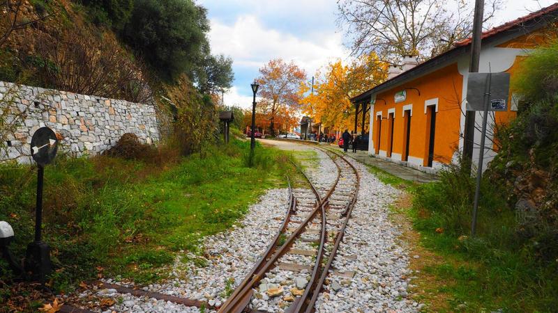
A 3-hour circular walk, from Milies train station to Vizitsa, then descending the kalderimi towards Kala Nera, until we meet the train rails and then following ...
Read more- Difficulty / Distance
- Easy
- 2.96km
- Altitudinal difference
- 196m
- 485m
- 289m
- Ascend/Descend
- 367m
- 190m
- 177m
- Duration
- 00:58
- Drinking water
- Vizitsa
- Marking
- Red marks
An easy, half-an-hour walk (one hour with return) from Milies train station to the village of Vizitsa, mostly on kalderimi. This path can also serve as a ...
Read more- Difficulty / Distance
- Easy
- 12.26km
- Altitudinal difference
- 245m
- 245m
- 0m
- Ascend/Descend
- 800m
- 413m
- 387m
- Duration
- 03:40
- 04:33
- Drinking water
- No
- Marking
- Red marks, round yellow signs
Ιn this walk, we go from Pagasitic gulf (Milina) to the Aegean sea (Chondri Ammos beach) in 2,5 hours and back to the Pagasitic (Mavri Petra is 2,8 km away from...
Read more- Difficulty / Distance
- Easy
- 6.64km
- Altitudinal difference
- 284m
- 289m
- 5m
- Ascend/Descend
- 537m
- 282m
- 255m
- Duration
- 02:00
- 02:42
- Drinking water
- No
- Marking
- Red marks
An easy circular walk, half οn earth road and half οn recently cleaned path. Starting off from the church at Milina, initially walk on the asphalt going to ...
Read more- Difficulty / Distance
- Easy
- 7km
- Altitudinal difference
- 323m
- 329m
- 6m
- Ascend/Descend
- 690m
- 345m
- 345m
- Duration
- 02:30
- 03:26
- Drinking water
- Παναγία Μεσοσπορίτισσα
- Marking
- Round yellow signs
One of the best circular walks in Pelion. In 2,5 hours we can climb from seaside Milina to the village square of Lafkos and come back, walking on kalderimi in a...
Read more- Difficulty / Distance
- Easy
- 3.15km
- Altitudinal difference
- 82m
- 82m
- 0m
- Ascend/Descend
- 294m
- 154m
- 140m
- Duration
- 01:00
- Drinking water
- Agia Varvara chapel
- Marking
- Red marks, some metal signs
This is an easy, one-hour walk connecting three fine beaches in East Pelion. Most of the walk takes place on earth road, but there are also sections of ...
Read more- Difficulty / Distance
- Moderate
- 17.82km
- Altitudinal difference
- 367m
- 469m
- 102m
- Ascend/Descend
- 1200m
- 600m
- 600m
- Duration
- 05:10
- 06:42
- Drinking water
- Unknown
- Marking
- Red marks, round signs
A circular walk, which can start either from Neochori or from Niaou (Afetes). Moving time 5.10', total time about 6,5 hours. Signed with red paint and round ...
Read more- Difficulty / Distance
- Easy
- 6.8km
- Altitudinal difference
- 348m
- 557m
- 209m
- Ascend/Descend
- 774m
- 373m
- 401m
- Duration
- 02:44
- Drinking water
- No
- Marking
- Red marks, round signs
This route, passing fron Agios Efstathios chapel, was cleared in 2013-2014 by the Friends of Kalderimi and Volos Alpine club. Start and finish at the villages` ...
Read more- Difficulty / Distance
- Moderate
- 11.54km
- Altitudinal difference
- 534m
- 534m
- 0m
- Ascend/Descend
- 1594m
- 818m
- 776m
- Duration
- 06:20
- Drinking water
- No
- Marking
- Red marks, blue marks
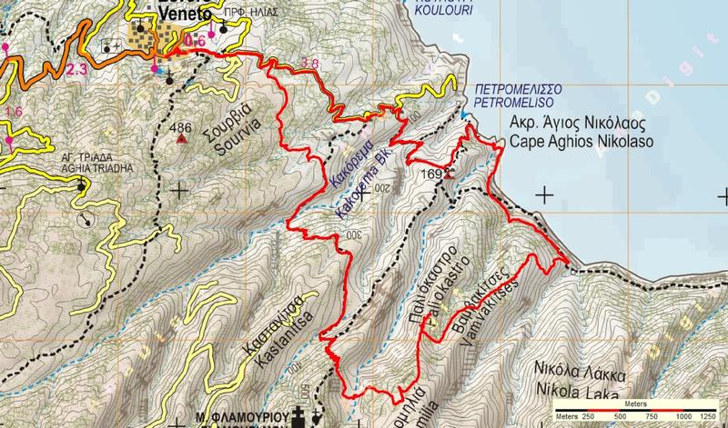
A 6-hour circular walk in Northeast Pelion near Veneto to visit the ruins of Paliokastro (old castle) and Agios Nikolaos (Flamouri monastery`s old dock). After ...
Read more- Difficulty / Distance
- Moderate
- 3.93km
- Altitudinal difference
- 612m
- 640m
- 28m
- Ascend/Descend
- 769m
- 687m
- 82m
- Duration
- 01:40
- 02:00
- Drinking water
- Unknown
- Marking
- Unknown
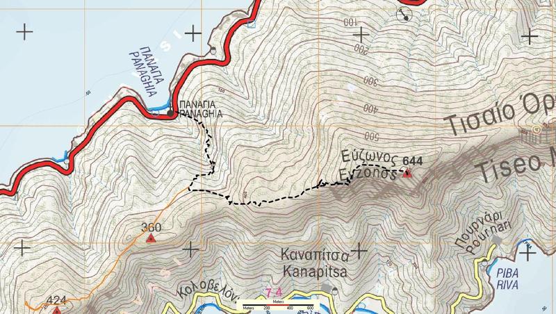
A path in South Pelion from Panagia church near Trikeri to the top of Tiseon (Evzonas, 644 m.). Best from late autumn to early spring, to be avoided in hot ...
Read more- Difficulty / Distance
- Moderate
- 10.89km
- Altitudinal difference
- 624m
- 655m
- 31m
- Ascend/Descend
- 1593m
- 839m
- 754m
- Duration
- 04:45
- 06:40
- Drinking water
- No
- Marking
- Red marks
Τhis walk starts from Panagia chapel next to the asphalt road going to Trikeri. Walking on a path marked with red paint, we get to a large clearing and turn ...
Read more- Difficulty / Distance
- Easy
- 1.74km
- Altitudinal difference
- 80m
- 590m
- 510m
- Ascend/Descend
- 205m
- 77m
- 128m
- Duration
- 00:56
- Drinking water
- No
- Marking
- Red marks, round yellow signs
This path was opened and signed in March 2016. Time 45-50'. Starting from the parking area at Pinakates, we initially walk on the asphalt, which then takes a ...
Read more- Difficulty / Distance
- Easy
- 9.56km
- Altitudinal difference
- 347m
- 350m
- 3m
- Ascend/Descend
- 719m
- 361m
- 358m
- Duration
- 03:30
- Drinking water
- Agios Nikolaos chapel
- Marking
- Red marks, round yellow signs
Starting from the beach of Platanias, we initially ascend towards Lafkos following the course of the old kalderimi (east route). When we reach the asphalt to ...
Read more- Difficulty / Distance
- Moderate
- 13.61km
- Altitudinal difference
- 379m
- 386m
- 7m
- Ascend/Descend
- 1246m
- 623m
- 623m
- Duration
- 05:59
- Drinking water
- Unknown
- Marking
- Unknown
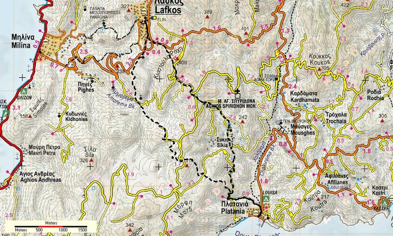
This circular walk combines the two routes Lafkos-Platanias (A and B, or east and west). Walking time 4 h, total time with stops 5 h. Starting off from the ...
Read more- Difficulty / Distance
- Moderate
- 7.33km
- Altitudinal difference
- 460m
- 930m
- 470m
- Ascend/Descend
- 778m
- 450m
- 328m
- Duration
- 02:35
- 03:19
- Drinking water
- Agia Triada in Portaria
- Marking
- Red marks, signs
A nice walk between the villages of Drakia and Portaria in Central Pelion, that will take about 3,5 h.(walking time 2.35'). Distance 7,5 km, max altitude 930 m...
Read more- Difficulty / Distance
- Easy
- 3.61km
- Altitudinal difference
- 466m
- 647m
- 181m
- Ascend/Descend
- 479m
- 20m
- 459m
- Duration
- 01:26
- Drinking water
- Unknown
- Marking
- Unknown
From Portaria we descend to the cobbled path to Katichori and continue on a path-rural road to 'Alli Meria, having a wonderful view to Volos and the Pagasitikos...
Read more- Difficulty / Distance
- Easy
- 2.24km
- Altitudinal difference
- 277m
- 592m
- 315m
- Ascend/Descend
- 336m
- 35m
- 301m
- Duration
- 00:37
- Drinking water
- Unknown
- Marking
- Unknown
Α pleasant 45-minute walk (walking time) from Portaria down to Stagiates and then, passing a stream and a ruined watermill, to the main road Volos-Portaria, at ...
Read more- Difficulty / Distance
- Easy
- 9.64km
- Altitudinal difference
- 216m
- 218m
- 2m
- Ascend/Descend
- 708m
- 354m
- 354m
- Duration
- 02:50
- 03:51
- Drinking water
- No
- Marking
- Red marks, round yellow signs
Starting from the beach of Potistika, we climb to the square of Xinovrisi where we can have a refreshment and then return back down to the beach following the ...
Read more- Difficulty / Distance
- Easy
- 5.63km
- Altitudinal difference
- 428m
- 441m
- 13m
- Ascend/Descend
- 627m
- 96m
- 531m
- Duration
- 01:50
- 02:37
- Drinking water
- Analipsi, Tourkovrisi, Parisena beaches
- Marking
- Red marks, some signs
In beautiful scenery, we walk down the kalderimi from Pouri village to the church of Kato Ai Giannis, just above the sea level, and then, passing from the ...
Read more- Difficulty / Distance
- Moderate
- 23.03km
- Altitudinal difference
- 545m
- 709m
- 164m
- Ascend/Descend
- 2052m
- 1026m
- 1026m
- Duration
- 07:35
- 09:00
- Drinking water
- Agios Georgios chapel, Pirgakia, Kserorema
- Marking
- Red marks, metal signs
This is a long, 9-hour circular walk, passing by the three old stone arched bridges built near Pouri and the ruined village of Palia Mitzela. For more ...
Read more- Difficulty / Distance
- Easy
- 8.19km
- Altitudinal difference
- 205m
- 205m
- 0m
- Ascend/Descend
- 451m
- 115m
- 336m
- Duration
- 03:00
- Drinking water
- No
- Marking
- Red marks, round yellow signs
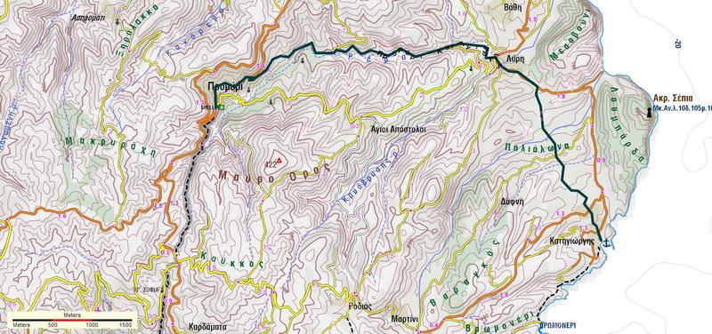
Starting from the gas station at the entrance of Promiri, we pass by the square, then past the church. After exiting the village, we continue on earth road ...
Read more- Difficulty / Distance
- Easy
- 6.14km
- Altitudinal difference
- 276m
- 285m
- 9m
- Ascend/Descend
- 361m
- 68m
- 293m
- Duration
- 01:45
- 02:01
- Drinking water
- Kanalakia, Ranti
- Marking
- Red marks, round signs
An excellent and easy downhill walk on kalderimi following a riverbed. Starting from the entrance of Promiri close to the gas station, we come to the Aegean sea...
Read more- Difficulty / Distance
- Easy
- 6.16km
- Altitudinal difference
- 244m
- 291m
- 47m
- Ascend/Descend
- 541m
- 241m
- 300m
- Duration
- 02:45
- Drinking water
- No
- Marking
- Red marks, round yellow signs
Starting at Siki square, we take the downhill concrete road (previously a kalderimi) and at the first junction go right, following the signs and the red paint ...
Read more- Difficulty / Distance
- Easy
- 5.94km
- Altitudinal difference
- 284m
- 292m
- 8m
- Ascend/Descend
- 435m
- 84m
- 351m
- Duration
- 02:15
- Drinking water
- No
- Marking
- Red marks, round signs
With this walk (duration 2hours 15') we get from Trikeri village to the harbour of Alogoporos, from which we can pass by boat to the island of Trikeri. It was ...
Read more- Difficulty / Distance
- Easy
- 2.86km
- Altitudinal difference
- 285m
- 286m
- 1m
- Ascend/Descend
- 303m
- 17m
- 286m
- Duration
- 01:07
- Drinking water
- Unknown
- Marking
- Unknown
A fine 1-hour walk from Trikeri to the seaside location of Kottes, half on kalderimi and half on wide path. Start from Trikeri square, take the kalderimi that ...
Read more- Difficulty / Distance
- Easy
- 1.85km
- Altitudinal difference
- 108m
- 559m
- 451m
- Ascend/Descend
- 134m
- 30m
- 104m
- Duration
- 00:43
- Drinking water
- Yes
- Marking
- Red marks, yellow signs
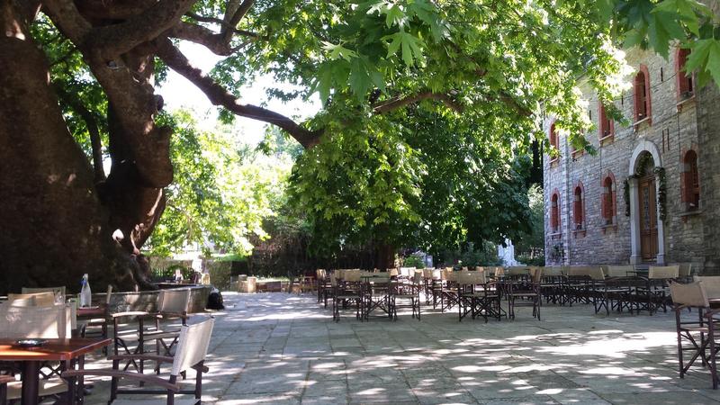
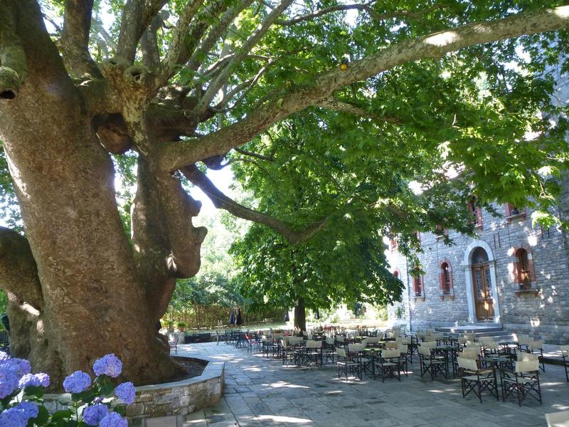
This is an easy and excellent walk through Tsagarada, connecting the square of Taxiarches to the square of Agia Paraskevi with the big plane tree. Duration 35 ...
Read more- Difficulty / Distance
- Easy
- 4.23km
- Altitudinal difference
- 462m
- 479m
- 17m
- Ascend/Descend
- 624m
- 93m
- 531m
- Duration
- 01:15
- 01:45
- Drinking water
- Agia Kyriaki fountain, Vainas fountain, Damouchari
- Marking
- Red marks, some signs
Αn easy downhill walk, on kalderimi, from Agia Paraskevi of Tsagarada to the picturesque seaside location of Damouchari (of Mamma mia! fame) and to the sandy ...
Read more- Difficulty / Distance
- Easy
- 7.9km
- Altitudinal difference
- 489m
- 498m
- 9m
- Ascend/Descend
- 924m
- 228m
- 696m
- Duration
- 02:30
- 03:15
- Drinking water
- fountain after Agios Georgios chapel, Agios Nikolaos chapel
- Marking
- Red marks, some signs
Ιn this walk, we climb down from Agia Paraskevi of Tsagarada to Fakistra beach, and then following the coastline reach the tourist seaside location of ...
Read more- Difficulty / Distance
- Moderate
- 12.85km
- Altitudinal difference
- 630m
- 800m
- 170m
- Ascend/Descend
- 1171m
- 826m
- 345m
- Duration
- 05:52
- Drinking water
- Flamouri mon.
- Marking
- Red marks, signs
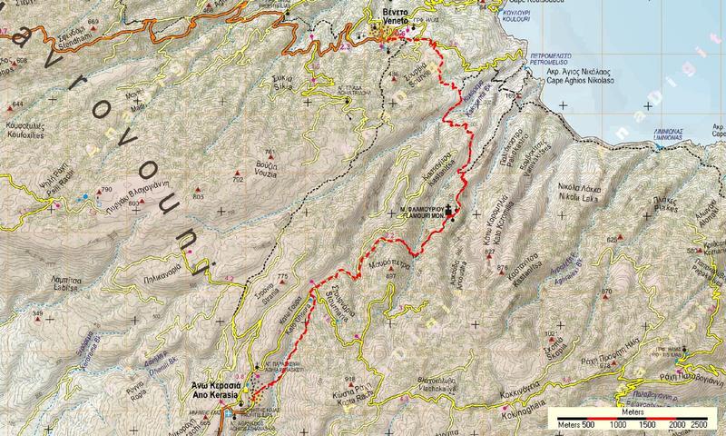
Starting from Veneto village square, we get to Flamouri monastery in 3 h. (walking time 2.20') and then continue to Ano Kerasia in another 2,5 h. (total walking...
Read more- Difficulty / Distance
- Easy
- 17.61km
- Altitudinal difference
- 563m
- 768m
- 205m
- Ascend/Descend
- 1548m
- 774m
- 774m
- Duration
- 07:55
- Drinking water
- Flamouri monastery
- Marking
- Red marks
Starting from Veneto, we go to the monastery of Flamouri. From there we go down to the watering can in Kato Goura. Here we turn right (west) going up the rocky ...
Read more- Difficulty / Distance
- Moderate
- 8.95km
- Altitudinal difference
- 257m
- 275m
- 18m
- Ascend/Descend
- 1055m
- 432m
- 623m
- Duration
- 03:45
- 04:30
- Drinking water
- No
- Marking
- Red marks, some signs
This excellent walk in north Pelion takes us from the village of Veneto to the beach of Kamari, near Keramidi. Moving time 3.45', total time 4-4,5 h., distance ...
Read more- Difficulty / Distance
- Moderate
- 14.4km
- Altitudinal difference
- 398m
- 608m
- 210m
- Ascend/Descend
- 1099m
- 594m
- 505m
- Duration
- 04:40
- 06:23
- Drinking water
- Mprovoniko fountain
- Marking
- Red marks, O2 signs
Part of the national trail O2, signed with red marks and metal signs. Walking time 4.40', total time about 6 hours. It is advisable to carry a cutter or a hand ...
Read more- Difficulty / Distance
- Moderate
- 15.89km
- Altitudinal difference
- 534m
- 534m
- 0m
- Ascend/Descend
- 1754m
- 877m
- 877m
- Duration
- 07:30
- Drinking water
- Flamouri mon.
- Marking
- Red marks, blue marks, metal signs
Α circular walk at the wild scenery of North Pelion near Veneto. Initially heading towards Flamouri monastery (we can visit the monastery too if we want, ...
Read more- Difficulty / Distance
- Moderate
- 21.48km
- Altitudinal difference
- 436m
- 453m
- 17m
- Ascend/Descend
- 1964m
- 1083m
- 881m
- Duration
- 06:45
- 09:25
- Drinking water
- Pirgakia, Kserorema
- Marking
- Red marks, O2 signs
This is a magnificent walk, a definite must if you are attracted to pure natural beauty (something that Pelion has in abundance). Part of the national trail O2...
Read more- Difficulty / Distance
- Easy
- 10.56km
- Altitudinal difference
- 314m
- 314m
- 0m
- Ascend/Descend
- 928m
- 464m
- 464m
- Duration
- 05:00
- Drinking water
- Unknown
- Marking
- Unknown
A circular route to visit the ruined shipyard of the monastery of Flamouri and the sea caves. The route starts from the Veneto, however if we have a 4x4 we can ...
Read more- Difficulty / Distance
- Moderate
- 11.55km
- Altitudinal difference
- 377m
- 394m
- 17m
- Ascend/Descend
- 1009m
- 503m
- 506m
- Duration
- 03:10
- 03:44
- Drinking water
- No
- Marking
- Red marks
Starting from Volos Football Stadium and Swimming center, we climb initially to the hill of Goritsa through the remains of an ancient city and continue on earth...
Read more- Difficulty / Distance
- Easy
- 4.19km
- Altitudinal difference
- 221m
- 221m
- 0m
- Ascend/Descend
- 346m
- 63m
- 283m
- Duration
- 01:23
- Drinking water
- No
- Marking
- Red marks, round signs
Αn easy and beautiful walk on kalderimi, cleaned and signed in 2016. Duration 1,5 hour (walking time 1.15'). The last section on earth road. Potistika is a ...
Read more- Difficulty / Distance
- Moderate
- 6.24km
- Altitudinal difference
- 464m
- 494m
- 30m
- Ascend/Descend
- 901m
- 442m
- 459m
- Duration
- 03:26
- Drinking water
- No
- Marking
- Red marks, metal signs
There are two hiking routes from Zagora to Horefto. Τhe southern starts from Agios Georgios main church via Zagorin and the other (northern) from Metamorfosi (...
Read more- Difficulty / Distance
- Moderate
- 11.89km
- Altitudinal difference
- 210m
- 1474m
- 1264m
- Ascend/Descend
- 1308m
- 650m
- 658m
- Duration
- 03:50
- 06:12
- Drinking water
- No
- Marking
- Red marks, some metal signs
A round walk in beech forest, starting from Hania ski center, that climbs to the two nearest peaks, Agriolefkes (1470 m.) and Schintzouravli (1450 m.). Walking ...
Read more